Towards the end of the Middle Ages, the sea estuaries of the Zwin and the Zwarte Gat silted up more and more. As a result, the prosperous trading town of Bruges became increasingly inaccessible to ships. In the years 1501-1505, a waterway was therefore dug between the Zwin and the Braakman: the Brugse Vaart. This new waterway crossed part of the old town of Oostburg. Three quarters of a century later, this channel also silted up. The current Groote Gat is a remnant of this old waterway.
At the end of the 1560s, the Revolt broke out in the Low Countries against the King of Spain. In 1580, Oostburg chose the side of the rebels. Three years later, General Alexander Farnese (since 1586 Duke of Parma) invaded the area to recapture it for the king. In order to prevent this, the sea dykes were opened and large parts of North Flanders were flooded (inundations), including the lands around Oostburg. The silted up Brugse Vaart became navigable once more. However, Farnese was not to be stopped and he almost managed to recapture all of Flanders. Only Terneuzen, Biervliet and Oostende remained in rebel hands.
To defend the recently reconquered land, the Spaniards built forts in strategic places, such as the Marolleschans, Hans Vrieseschans, Coxyschans, Sint-Cathalijneschans, Fort Sint Philip, a redoubt near (Nieuw-) IJzendijke and between the last two another four redoubts (see the map).
In 1604, Prince Maurits landed in the Land of Cadzand with a huge invasion fleet. The Spanish forts around Oostburg were captured without much difficulty. After the recapture of Sluis - some 4 months later - the States General decided, on the advice of the Prince, to construct the (later so-called) Line of Oostburg. This line consisted of existing (refurbished) Spanish forts and some new ones.
One of those new forts was the Nijevelt redoubt or Nieveltschans, named after Abraham Nievelt, the engineer responsible for building the fort. The redoubt was constructed on the other side of the Brugse Vaart to counter the Frederik Hendrik redoubt.
On the eastern side, both forts had a ravelin, a small extra fortification.
The Frederik Hendrik redoubt was linked by an embankment with the Slikkenburg redoubt to the northeast, thus offering the town of Oostburg (or what was left of it) protection against attacks from the east. Over ten years later, a connecting embankment was also constructed slightly more to the west. This was strengthened with three bastions. Thus the stronghold Oostburg was created and part of the medieval town came to lie outside the walls.
In the middle of the dyke between the Nieveltschans and the Cathalijneschans, a small square fort was built: the Spek en Brood redoubt. Opposite the Cathalijneschans, the Kaas en Brood redoubt rose on the northern bank. On a map from the start of the 17th century, the Spek en Brood redoubt is not yet shown. On maps from the middle of the 17th century, they are shown. This could indicate that the redoubt had been constructed in response to the attack by Spanish troops in 1621.
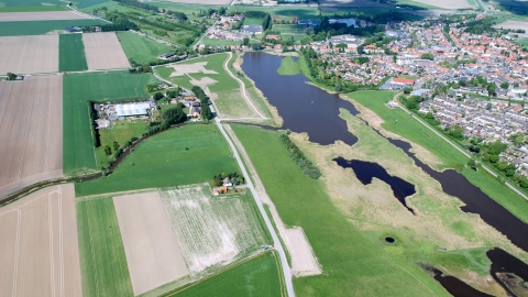
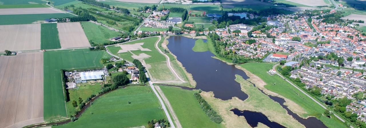
Due the further silting of the Brugse Vaart and land reclamations, the Line of Oostburg gradually lost its function. In 1673, the line was abandoned and demolished. Today, a few mounds in the landscape are a reminder of the location of some of the forts.
In the framework of the Implementation Programme National Landscape Southwest Zeeland, based on archaeological research, the contours of the Nijevelt redoubt and the Spek en Brood redoubt were determined. Within these contours, in the winter of 2010/2011 the ground level was raised slightly making the position and size of the forts easier to see. The route of the former line dyke, which linked both forts with each other and the Cathalijneschans, was also elevated slightly.

