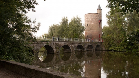
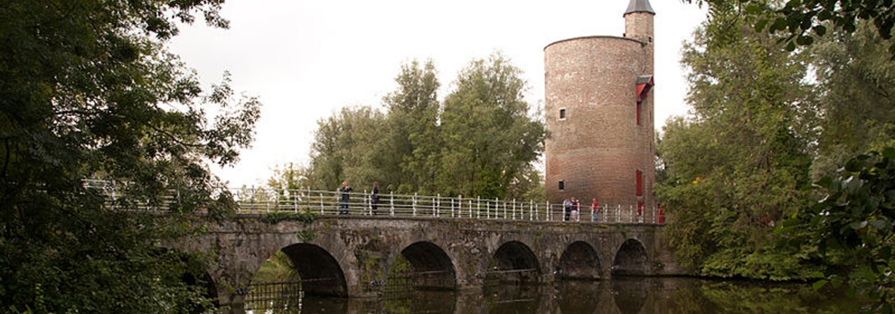
Bruges developed in the 9th century from a fortified core around the castle or “castrum”, the current Burg. The ramparts were expanded in phases, the first of which took place in the 12th century (a 4 km long palisade with towers and redoubts). A more extensive defence belt was built in the 13th century (2 earthen embankments and 2 moats with 7 bridge towers) when Bruges was a world famous trading centre. Numerous mills were erected on the inner embankment. In the 15th century, walls were built between various town gates. In order to offer resistance to attacks by enemy artillery and canons, the fortification underwent a radical modification in the 17th century, based on Italian military architecture: massive earthen embankments, heavy brickwork, a double ring of bastions, each protected by a wide moat. In around 1665 an extra fortification was built level with the Handelskom, at the beginning of the canal to Oostende, on the northern edge of the town: Fort Lapin. This fortification consisted of a crownwork on the east side of the Zwaaikom (turning basin). In 1782, Jozef II ordered the fortifications to be dismantled. He deemed that their maintenance was a needless drain on treasury resources in view of the dwindling threat expected from either France or the United Provinces. Thanks to regular upkeep and planting work, the fortifications became a popular place for walking. A general (landscape) plan was drawn up in the 19th century aimed at turning them into a “pleasant public footpath”. The result of these efforts is that Bruges still has a green inner ring surrounding the town, although only a fraction of the original contours are visible. The fortifications harbour a wealth of historic monuments such as the Poertoren and the Minnewaterbrug, warehouses and windmills. The shooting ranges of the longbow and crossbow guild on the Kruisvest were left as they were. The Fort Lapin was incorporated into a new residential area.