In around 1580, all of Flanders was on the side of the Revolt against the Spanish king. The commander of the Spanish army, Alexander Farnese (the Duke of Parma), was ordered to win back the lost areas.
In order to block his advance, the rebels opened the dykes in several places between 1583 and 1586, resulting in the flooding of large areas of northern Flanders.
In 1583, the entire land to the east of the Land of Cadzand and to the north of Oostburg was flooded (inundation). To the east of what is now Breskens, a tributary emerged, the Nieuwershavensche Gat, that later joined up with the Zwarte Gat: the tidal channel between Zwin and the North Sea, which flowed along the eastern side of the Land of Cadzand.
After the recapture of the Land of Cadzand, the Spaniards built several forts in strategic places. One of these forts was constructed on the easterly dyke of a section of the Zwarte Gat which was reclaimed in 1602 (the Grote Sint-Annapolder). In the east, it bordered the flooded area and was close to the place where the Nieuwerhavensche Gat emerged in the remains of the Zwarte Gat.
In 1604, Prince Maurits landed with a big invasion army in the Land of Cadzand. He quickly captured a large part of what is now West-Zeeuws-Vlaanderen. The Spanish forts surrendered into States hands.
Maurits was keen to strengthen some of these forts, including the fort on the dyke of the Grote Sint-Annapolder. In 1605, the States General gave the order. Since then, the fort has been known by the name Redoute Marolleput or Marolleschans.
In the city archives of Bruges, there is a (construction) drawing of the redoubt dating from just after 1600. It is not certain whether the redoubt really looked like the picture. The caption to the drawing states that the fort was partly built in the dyke and was surrounded by embankments. On the south-easterly side (towards the inundation area), it had a bastion. On the site of the dyke (where there was no moat), it was protected by palisades. Within the embankments, there was a “cordegarde” (guardhouse) with two “spietorentjes” (watch towers).
Following the reclamation of the flooded areas on the eastern side (between 1615 and 1637), the redoubt lost its strategic importance. The part outside the dyke had already been washed away. In the middle of the 17th century, the redoubt no longer appeared on any maps.
The redoubt was built at a "(h)yde" or “(h)ide” (a small medieval harbour or jetty) which emerged in the Zwarte Gat and which was connected on the land side with a waterway. In the harbour, goods like salt, turf and wool were transhipped. A map from 1572 shows the harbour mentioned by the name Morelleput and it seems to have been closed off. Morelle is dialect for samphire, which may have flourished in the unused harbour.
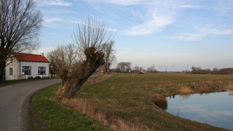
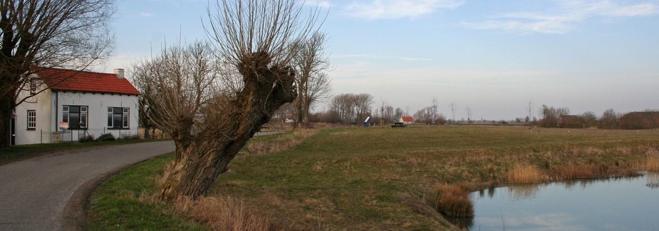
The harbour is still recognisable from the strange bend that the dyke makes at this point. In the framework of the Implementation Programme National Landscape Southwest Zeeland in 2010, a layer in the arable land in the inside of the bend was dug down to below the groundwater level. The excavated soil was used to “restore” the quay on the north side.
The redoubt was probably located on the dam which closed the harbour on the west side, or where the dyke widened to the north (where this information panel now stands). On this elevation, there was once a ferry house. From here, there was a ferry link with Oostburg. The house was destroyed in fighting in October 1944 and then demolished.

